
Tags
British Pilgrimage Trust, Chalice Hill, Chalice Well, Glastonbury Tor, Glastonbury Way, Gog and Magog, Holy Grail, Joseph of Arimathea, Mendip Transmitting Station, Somerset Levels, Somerset Levels and Moors, St Cuthbert's Wells, St Michael's Glastonbury, Wells Cathedral, White Spring and Temple
Thanks to the British Pilgrimage Trust, I have now been able to include a plan of the Glastonbury Way, and not just provide a link to the Way’s Facebook page to see one. (Sadly it does not include the Board numbers, being concerned rather with spiritual points of interest.)

In September, Zoe and I had walked Part 1, nearly all of the western half of the Way, cutting out just a little from each end for the sake of convenience. Likewise in November we cut the very beginning of the second part, joining it as it turns east off the central ‘square’ portion.
I took fewer photos this time. The scenery was very attractive, but there was not a great deal of variety. The overall length of the walk was about the same, as can be seen.


The views to the north across an outpost of the Somerset (Levels and) Moors, all along the west-east ridge that is Paradise Lane, are lovely, and it was difficult not to overshoot – photos that is.

According to the weather forecast, we should have lost the sun by now, but we didn’t for another hour or so.
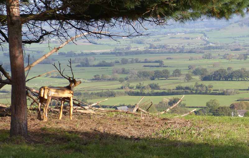


In the distance,

using the zoom on my camera, can be seen the tower of St Cuthbert’s Church in Wells, and the city’s cathedral. The radio mast (Mendip Transmitting Station) can be seen for miles around, and even in Wales when its red safety lights show up at night.

‘Gog and Magog [I quote from the app] are the only surviving exemples of the Avalon Oaks. These were a group of oaks that were mostly felled in 1906. One of these great oaks possessed a diameter of 10 feet 9 inches, (3.35 m) and a circumference of 34 feet 4 inches (10.5m). This suggests an age of at least one thousand years. Gog is now expired having been damaged by fire in 2017. Magog survives and provides a living link with our mediaeval past.’

It was a hard slog up the long Stone Down Lane, parallel with Paradise Lane, and this is the only photo I took on the way.

Once arrived at the Tor, we decided not to go up, but to take the alternative route round it.

Once round the other side, we came to the Chalice Well area. One of the houses had a most beautiful fuchsia at the side of the road. I took lots of photos of the bush, and chose this one.

This is not in fact the Chalice Well, which is accessible only behind a pay wall (as it were!) This is the White Spring and Temple. Whenever I have passed it before it has had many ‘alternative’ people there, and I have not ventured close.

Chalice Well is round the corner.


The description of the formal Way ends here, but those who parked their car near Glastonbury Information Centre, where the Way starts, would have ten minutes further to walk. It was eight minutes or so in the opposite direction to my house. We noted this panel on the side of a house on the main road we had to cross.

We headed away from Glastonbury for our ‘pub’ lunch, and found that our destination in Butleigh no longer served food at lunchtimes. That led to the serendipitous discovery of a very nice coffee shop there, which served much more than its description suggested.

The coffee shop sounds like an excellent find. Loved the views on your walk especially some very old trees.
LikeLike
That coffee shop will be revisited – and no doubt the trees too.
LikeLike
Glad to hear it.
LikeLiked by 1 person
The boards are amazingly lively. The fuchsia is very pretty indeed. I was much taken by the notion of a literal paywall.
LikeLike
I think the people working on the boards have done an excellent job of respecting strict historical accuracy and the beliefs of those for whom the mystical traditions of the area are important.
LikeLiked by 1 person
I wonder why they felled the oaks in 1906? And I have never seen that colour combination in a fuchsia before – beautiful!
LikeLike
Yes, it was striking! And very sad about the oaks.
LikeLike
Really enjoyed the tour – some splendid views through the trees. And the fuchsia colour was most unusual.
LikeLike
Like Willow Walk in Part 1, Paradise Lane is well-named.
LikeLike
Dire que c’est en novembre que tu as eu du soleil… La sculpture du cerf est très sympa et bien placée.
La touche d’humour finale est parfaite pour contrebalancer le sérieux des informations qui animent le parcours, aussi bien historiques que légendaires !
LikeLike
We’ve had more sun today – and a biting wind!
LikeLike
How lovely to have such an historic and beautiful walking route on your doorstep. It’s great that you take advantage of local landmarks etc. and it’s appreciated that you take the time to share them. Something new I learned……………hippies in 1860 ??! x
LikeLike
I don’t think so…!
LikeLike