Tags
Glastonbury, Glastonbury Tor, Millfield Prep, Ponters Ball, River Brue, sheep, Somerset Levels, Somerset Moors and Levels, swan
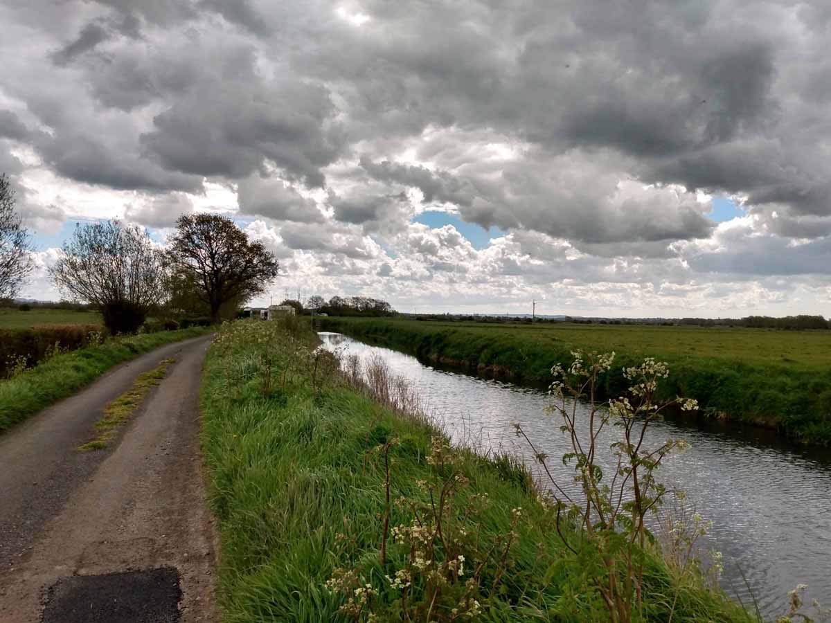
Yesterday was the second of my resumed monthly walks with my friend Zoe, though sadly the pub lunch at the end will not resume until next month – hopefully. We started from my house, and followed a route I had done once before, many years ago, but which I had not felt able to do more recently as I didn’t want to venture alone along that part of the route which lines the River Brue. It is now populated with somewhat scruffy residential caravans, past which I would not wish to go alone. There were many more caravans than shown here.
The walk was a little longer than planned, as what we did for a time clearly did not fit with what was on the OS map. I had had no problem with this when I had previously done the walk. Perhaps we were just chatting too much. I think I know now what went wrong, and am tempted to go and check it out sometime, but…


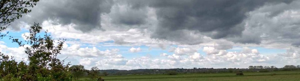
The walk was on a very local patch of the Somerset Moors, a.k.a. the Somerset Levels, though technically those are off to the west, bounded roughly by the M5 motorway. Over the centuries from Roman times they have been progressively drained, turning from marshes into pastureland. (The Draining of the Somerset Levels, by Michael Williams is fascinating on the subject.) They abound in ditches and rhynes (pronounced ‘reens’) and if you can help it you don’t set off across a field unless you know for sure that you will not be cut off at the other side by a water course too wide to leap across. (Moors, levels, rhynes explained here.)

A much enlarged clip from the above picture will show how the local authority is meeting the obligation placed on it by the government to provide sanitation for the caravan dwellers during the pandemic, as part of its campaign to get the homeless off the streets. This is to end after 17th May.

Glastonbury Tor accompanied us throughout.


Having passed this caravan I turned round to take a photo of the mattress lying among the branches of the tree, and the solar panel.

No wonder the road patches had seemed fresh!

Difficult not to stop and watch little lambkins. West Pennard Hill in the background.

When we caught sight of this swan it was way off, but when it caught sight of us it swam purposefully in our direction.

And swam purposefully away from us once it saw we had nothing to give it.

It was around here that we started to suspect we weren’t quite sure that we were where we thought we were. Still, it’s a nice bridge, of sorts.

We stood looking at this flock for quite a long time. After all, we had to make sure that each of the four lambs dispersing from playing together managed to find its right mother.


It this point I thought we were on Ponters Ball, a local earthwork of unknown age and purpose. Glastonbury is, in effect a peninsula, surround by Moors, formerly marshes. This earthwork marks the fourth, non watery, side of the peninsula. The earthwork did not particularly impress Zoe, who had not heard of it before I drew it to her attention as we made our arrangements.


In any case, I was wrong. This was Ponters Ball, reached ten minutes later. Looking southwards,

and here northwards. Zoe was a little more impressed. And from here on we knew exactly where we were.


Some furry creature has come to a sad end, at the hands – or more probably claws of a feathery creature


We were well and truly on the homeward stretch now, here entering the grounds of Millfield Preparatory School.

Tennis practice. And we also saw equestrian practice, but were too close for comfortable photography … and the battery of my phone – I had not bothered with my camera as I didn’t expect to take any photos – was running out.

Just enough juice to take one last picture of the Tor.


Very dramatic skies – and I always feel guilty when a swan swims up looking expectant and goes away disappointed. Well done on getting out and about – it’s blowing a hooligan again here!
LikeLike
So it is here today! But yesterday was much better, though there was chill wind blowing at times. I didn’t really notice just how dramatic the skies had been until I saw the photos.
LikeLike
A most interesting post, an area I know nothing about. Thank you for widening my knowledge.
LikeLike
That the area is relatively unknown is part of its charm.
LikeLike
A walk full of interest. My brother has an OS app on his phone which tells you exactly where you are and where any nearby footpaths are.
LikeLike
Zoe’s husband has too, but he wasn’t with us. ‘Maps’ was of limited use, as it only shows roads.
LikeLiked by 1 person
Enjoyed the tour and the variety of cloudscapes. Lots of interest to see, and good that you managed to find your way.
LikeLike
It was indeed!
LikeLike
Très beau ciel, c’est sûr ! J’aime particulièrement la 2e photo, de niveau avec la végétation. Beaucoup de ressemblance avec les paysages de ma virée récente dans le Marais poitevin, surtout pour la partie vendéenne moins boisée qu’en Deux-Sèvres. Marais également canalisé par des moines et que tu connais aussi !
LikeLike
My initial reaction is to say that this area is nothing like the Marais Poitevin! But then my recollection of the MP is of wonderful warmth, sunshine, and gentle navigation on those flat punt-like boats, (whose name I’ve forgotten), along very pretty canals wit overhanging trees. The River Brue is not navigable – well I’ve never seen any boats on it – and the rhynes certainly not, being only a metre or so wide! But I understand, I think, why this blog has brought up memories for you. I should love to see a cow on a punt on the Brue!
LikeLike
La partie “Venise Verte” correspond bien à tes souvenirs, mais il y a ensuite toute une partie jusqu’à la côte, nettement moins touristique, qui ressemble plus à ta River Brue. Je t’enverrai des photos 😉
LikeLike
Ah yes, it was “Venise Verte” of which I was thinking. I guess the MP and the Somerset Moors were formed the same way as each other. I look forward to the photos.
LikeLike
I am caught up now! That is some beautiful countryside there for walking.
LikeLike
Yes, I feel pretty fortunate. Thanks for the marathon visit!
LikeLiked by 1 person